Unveiling the Charm of Corkscrew Hill in Ballyvaughan Ireland

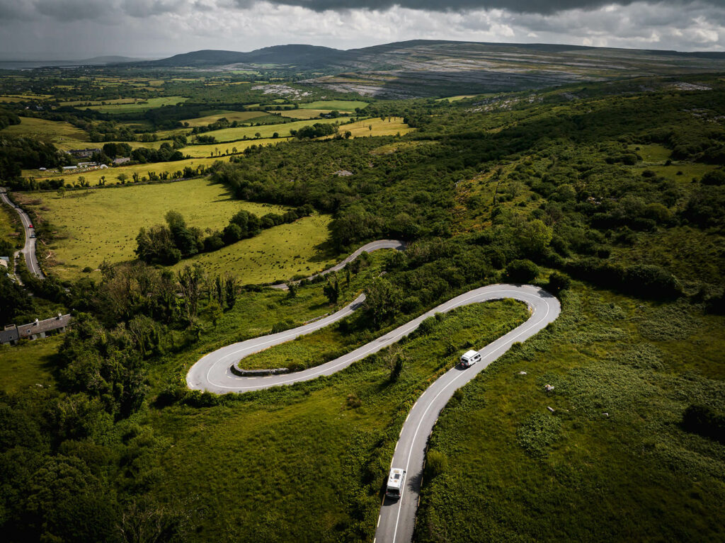
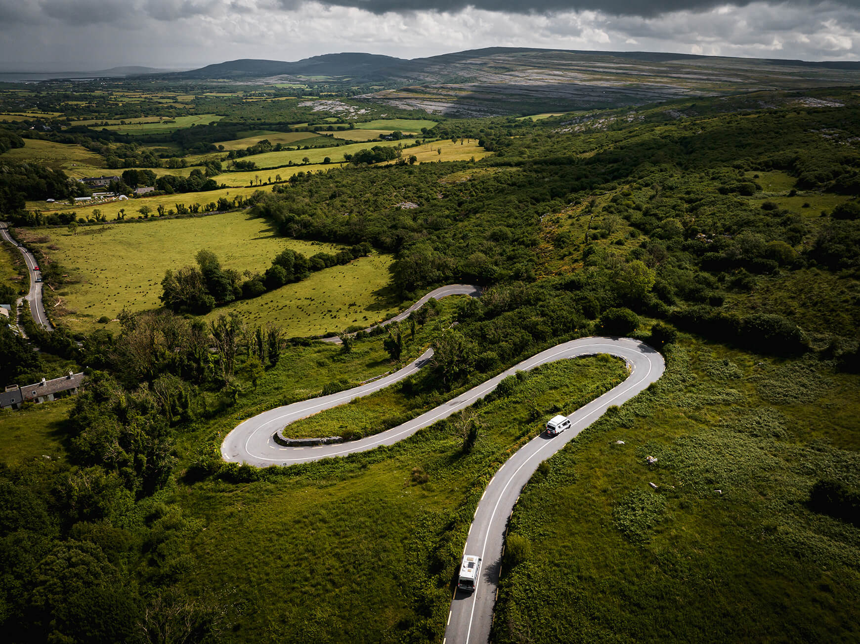
Corkscrew Hill Ireland

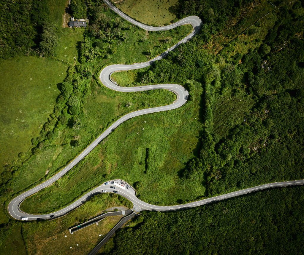
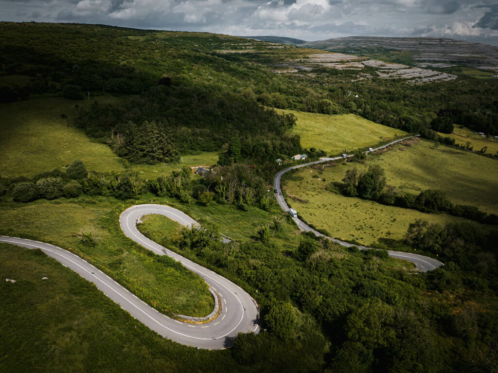
Corkscrew Hill

Ballyvaughan, Co. Clare

Unveiling the Charm of Corkscrew Hill in Ballyvaughan, Co. Clare, Ireland: A Day Trip Adventure

Nestled in the breathtaking landscapes of Co. Clare, Ireland, Corkscrew Hill in Ballyvaughan awaits adventurous souls seeking a scenic day trip. With its proximity to Galway City, this enchanting destination offers an escape into the natural wonders of the Burren and a plethora of nearby attractions. Prepare to embark on a journey filled with awe-inspiring vistas, cultural discoveries, and unforgettable experiences.
Corkscrew Hill Ireland
Copyright 2023 Superfly Ireland Request to Licence

Located approximately 60 kilometers south of Galway City, Corkscrew Hill makes for an ideal day trip. The leisurely drive through the stunning Irish countryside offers picturesque views, with winding roads that lead you to the charming village of Ballyvaughan. As you venture along the way, keep your camera ready to capture the breathtaking panoramas that unfold before your eyes.

Corkscrew Hill is a gateway to the mystical Burren, a captivating karst landscape unlike any other. Sprawling over 250 square kilometers, this unique region showcases a diverse blend of limestone pavements, ancient ruins, wildflowers, and rare flora. Embark on a hike along the trails, marvel at the limestone cliffs, and immerse yourself in the ancient history and geological wonders that make the Burren a true natural treasure.
Copyright 2023 Superfly Ireland Request to Licence

Beyond the allure of Corkscrew Hill and the Burren, a myriad of attractions awaits in the surrounding area. Here are a few notable highlights to enhance your day trip experience:

Aillwee Cave: Located just a short distance from Ballyvaughan, Aillwee Cave invites you to delve into an underground world of stunning stalactites, stalagmites, and cascading waterfalls. Take a guided tour and witness the natural wonders hidden beneath the surface.

Cliffs of Moher: A short drive from Ballyvaughan lies the iconic Cliffs of Moher, one of Ireland’s most renowned natural landmarks. Be awestruck by the dramatic cliffs plunging into the Atlantic Ocean, and soak in the awe-inspiring vistas from the designated viewing areas.

Poulnabrone Dolmen: Step back in time with a visit to the Poulnabrone Dolmen, an ancient megalithic tomb that stands as a testament to Ireland’s rich history. This iconic site, dating back to the Neolithic period, is shrouded in mystery and intrigue.

Traditional Irish Music: Immerse yourself in the vibrant culture of Ireland by seeking out local pubs in Ballyvaughan or nearby towns like Doolin, where traditional Irish music sessions create an atmosphere of joy and camaraderie.
Copyright 2023 Superfly Ireland Request to Licence
  • Corkscrew Hill in Ballyvaughan, Co. Clare, is a gateway to an unforgettable day trip adventure. From its close proximity to Galway City to the awe-inspiring wonders of the Burren, this region offers a harmonious blend of natural beauty, cultural heritage, and exhilarating experiences. Embark on this journey, and let Corkscrew Hill be the starting point for a memorable exploration of Ireland’s west coast.

If you’d like to see more content like this, please drop us a message on the contact form.

Additionally, at superfly.ie, we sometimes license the content featured on our site, so don’t hesitate to ask.

Salmon Weir Bridge is Officially Open

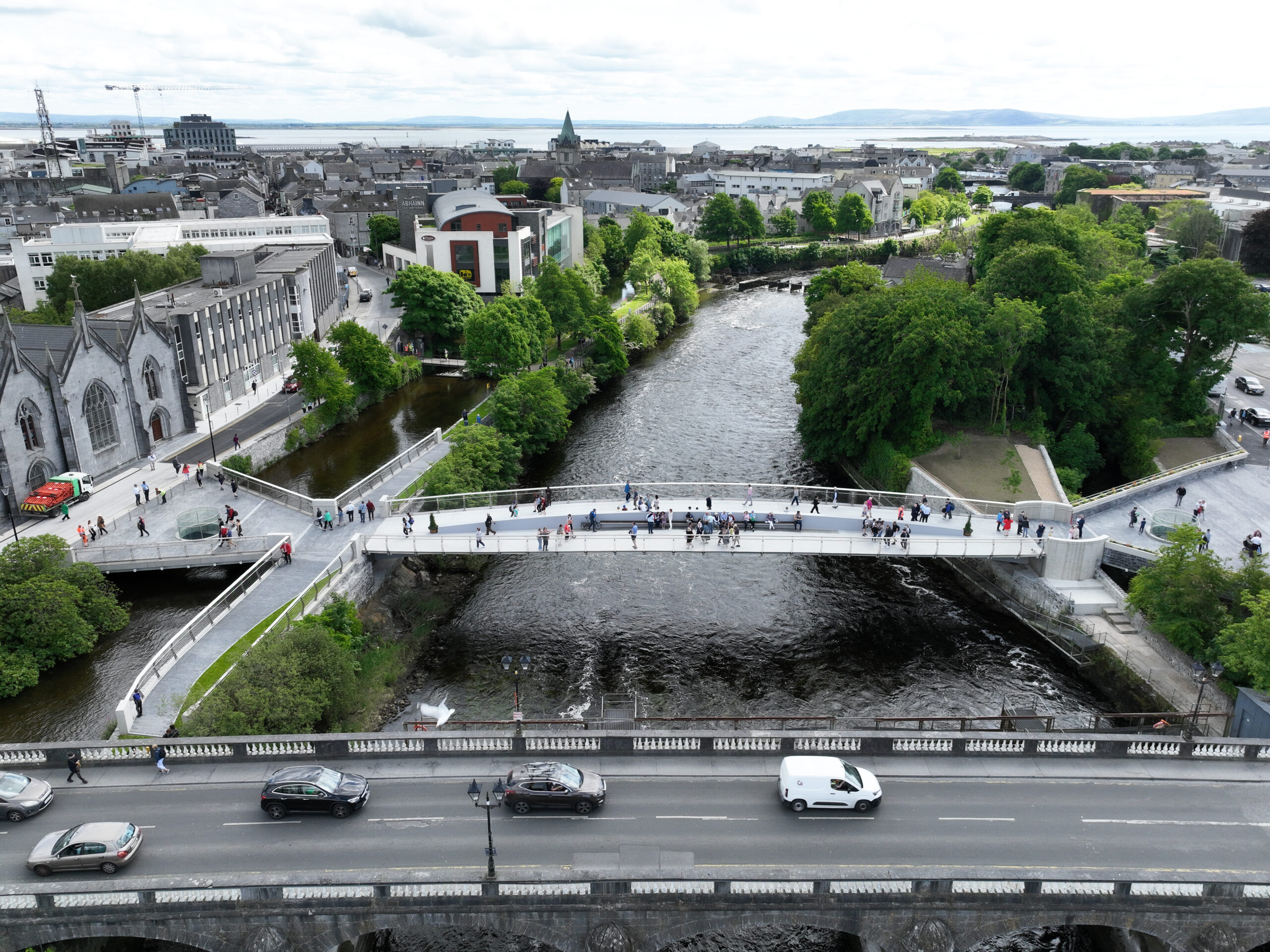
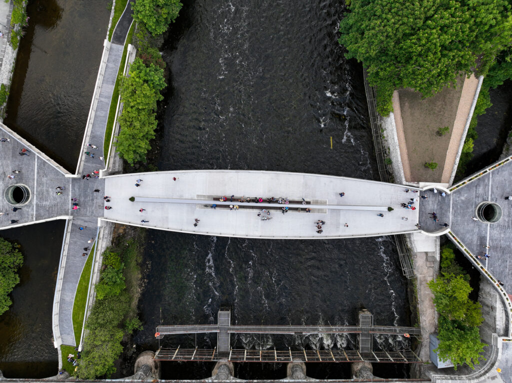
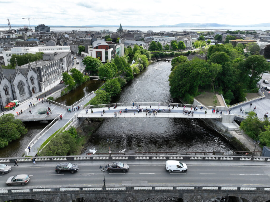
New Bridge Galway

Historic Moment for Galway

The un-named Salmon Weir Pedestrian and Cycle Bridge officially opens 26/05/2023.

The un-named Salmon Weir Pedestrian and Cycle Bridge officially opens 26/05/2023. ​

Galway City, a place steeped in rich history and natural beauty, has just added another remarkable landmark to its collection. With great fanfare and anticipation, the city recently celebrated the official opening of a brand-new bridge located beside the old Salmon Weir. This architectural marvel, yet to be named, has already become a symbol of Galway’s progress and commitment to connectivity. The event witnessed the esteemed presence of the Mayor of Galway, Galway City Council representatives, and other stakeholders, with Superfly Ireland and Xposure.ie capturing the day’s aerial photographs and video footage.

Copyright 2023 Superfly Ireland

A Bridge Rooted in History

The location of this stunning bridge, adjacent to the centuries-old Salmon Weir, adds a touch of historic significance to its construction. As Galway City has evolved over the years, so too has the need for improved infrastructure to accommodate its growing population and bustling tourism industry. The bridge stands as a testament to Galway’s ability to blend contemporary design with its rich heritage, paying homage to the past while embracing the future.

Unveiling Ceremony

The official opening of the bridge was a grand affair, marked by a celebratory ceremony attended by prominent figures in Galway’s administration. The Mayor of Galway, along with Galway City Council representatives and other stakeholders, gathered on the bridge to witness its inauguration. The event was a moment of pride for the city, showcasing the collaborative efforts that brought this ambitious project to fruition. infrastructure to accommodate its growing population and bustling tourism industry. The bridge stands as a testament to Galway’s ability to blend contemporary design with its rich heritage, paying homage to the past while embracing the future.

Aerial Captures by Superfly Ireland and Xposure.ie

The breathtaking beauty of the bridge and its surroundings was skillfully captured by Superfly Ireland and Xposure.ie, two renowned companies specializing in aerial photography and videography. Their expertise brought a unique perspective to the event, showcasing the bridge’s architectural magnificence against the backdrop of Galway City’s picturesque landscape. These stunning visuals captured the excitement and significance of the day, leaving a lasting imprint in the memories of all those present.

The new bridge serves a vital purpose in enhancing connectivity within Galway City. It provides a seamless connection between different parts of the city, easing traffic congestion and promoting pedestrian and cyclist-friendly transportation. Furthermore, the bridge’s strategic location near the Salmon Weir not only serves as a visual attraction but also symbolizes the link between Galway’s past and its vibrant future. It encourages reflection on the city’s journey and the importance of preserving its heritage while embracing progress.

New Bridge Galway
Copyright 2023 Superfly Ireland

Beyond its functional aspects, the bridge holds immense significance for the Galway community. It stands as a tangible representation of the city’s commitment to growth, development, and improved infrastructure. The bridge’s presence will undoubtedly contribute to Galway’s tourism industry, attracting visitors who are eager to experience the city’s unique blend of history, culture, and natural beauty. Moreover, it will enhance the quality of life for local residents, providing them with a convenient and aesthetically pleasing means of traversing the city.

The Bridge's Name

While the bridge remains nameless as of now, the Galway City Council has initiated a public engagement process to involve the community in the selection of a suitable name. This approach ensures that the bridge’s identity reflects the aspirations and values of Galway’s residents. It is an opportunity for the people of Galway to leave their mark on the city’s history, ensuring that the bridge becomes a cherished symbol for generations to come.

The unveiling of the new bridge is a momentous occasion that signals Galway’s continued progress and commitment to enhancing its infrastructure. The bridge represents a harmonious blend of contemporary design and historical significance, capturing the essence of Galway’s vibrant

Client: Press Photographer Andrew Downes Xposure.ie

Aerial Photography Progress Report for Alber Homes Housing Development

Aerial Progress Report

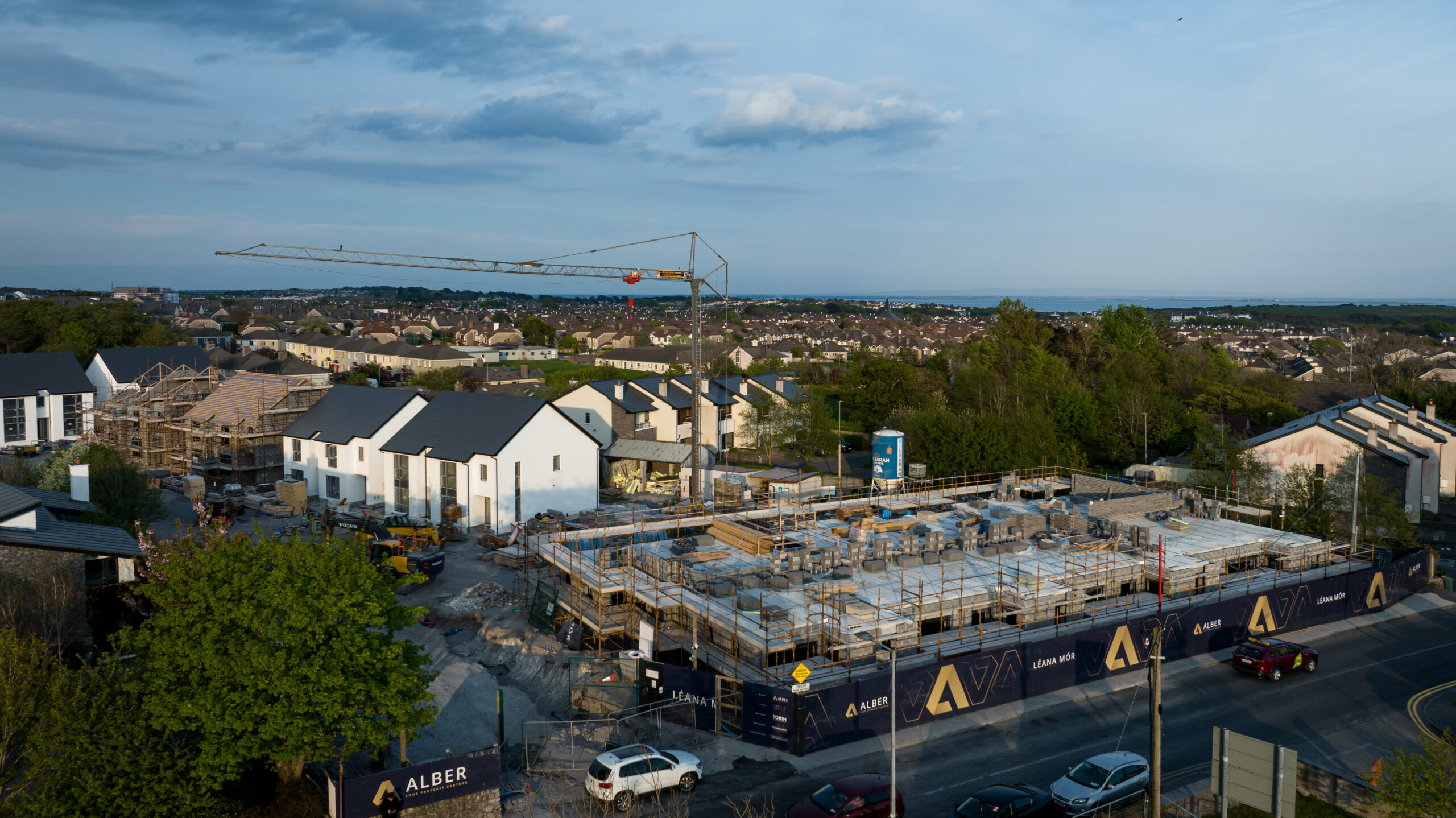
for Alber Homes Housing Development Cappagh Road, Galway

Aerial Progress Report for Alber Homes Housing Development
Cappagh Road, Galway

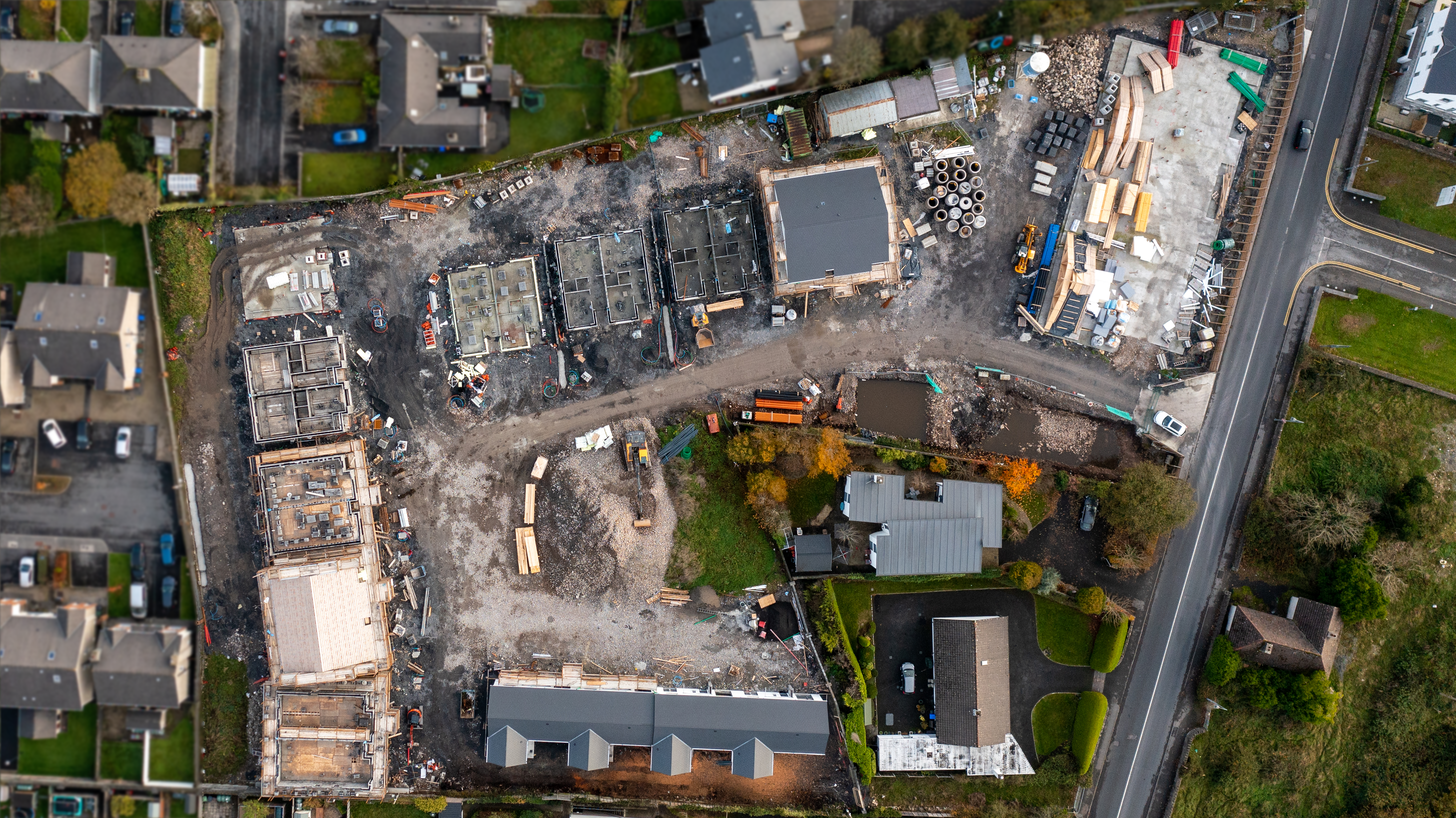
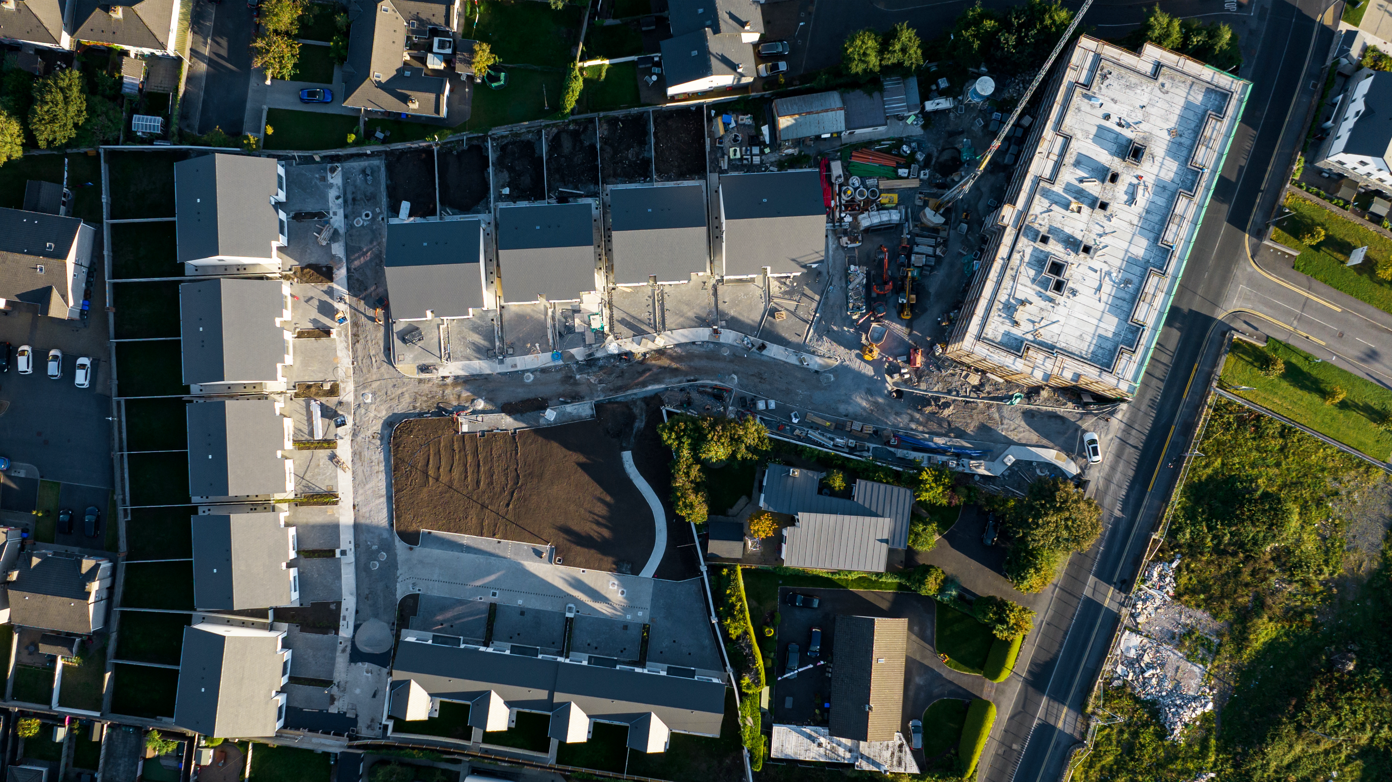
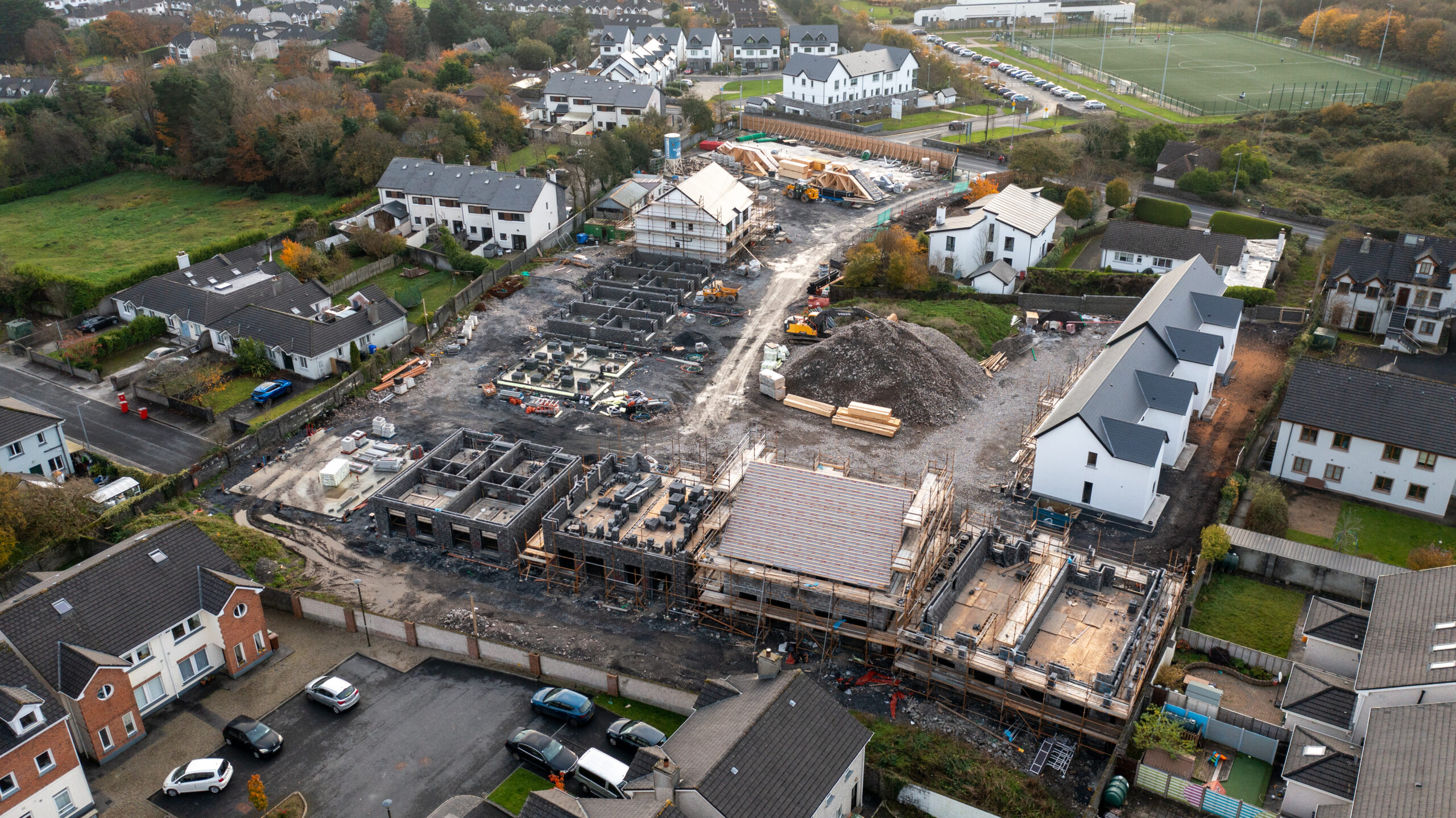
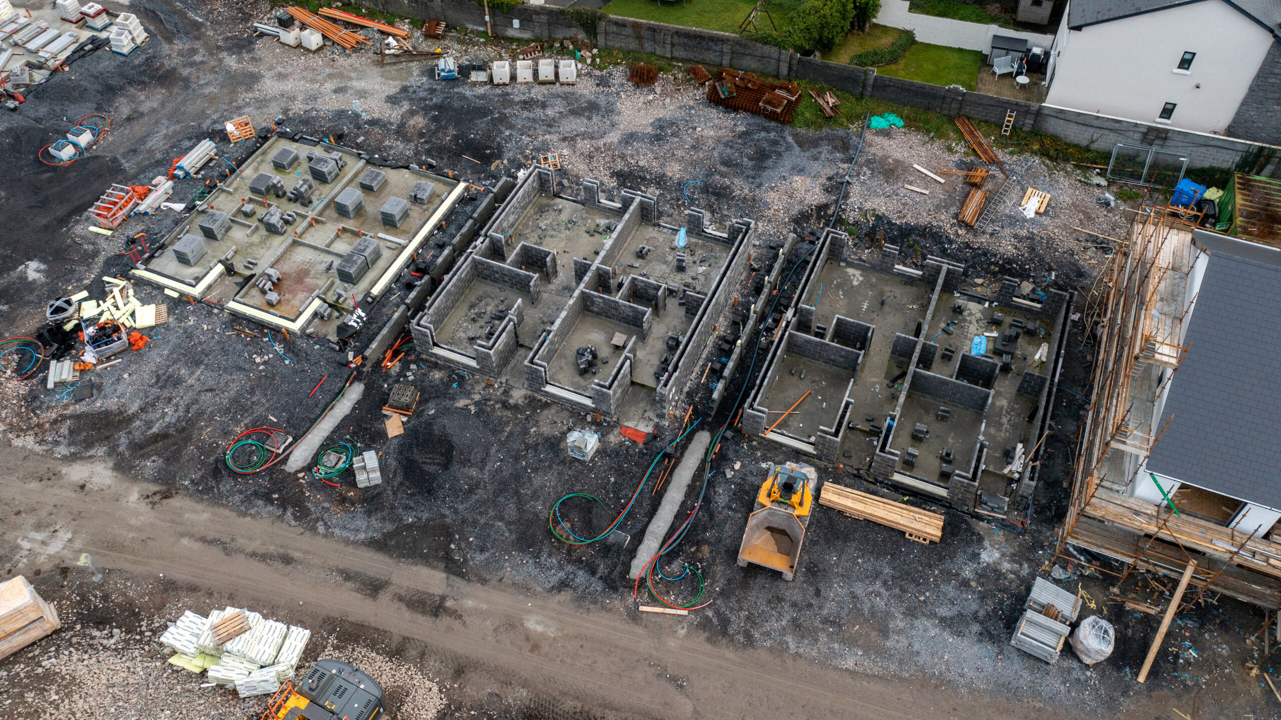
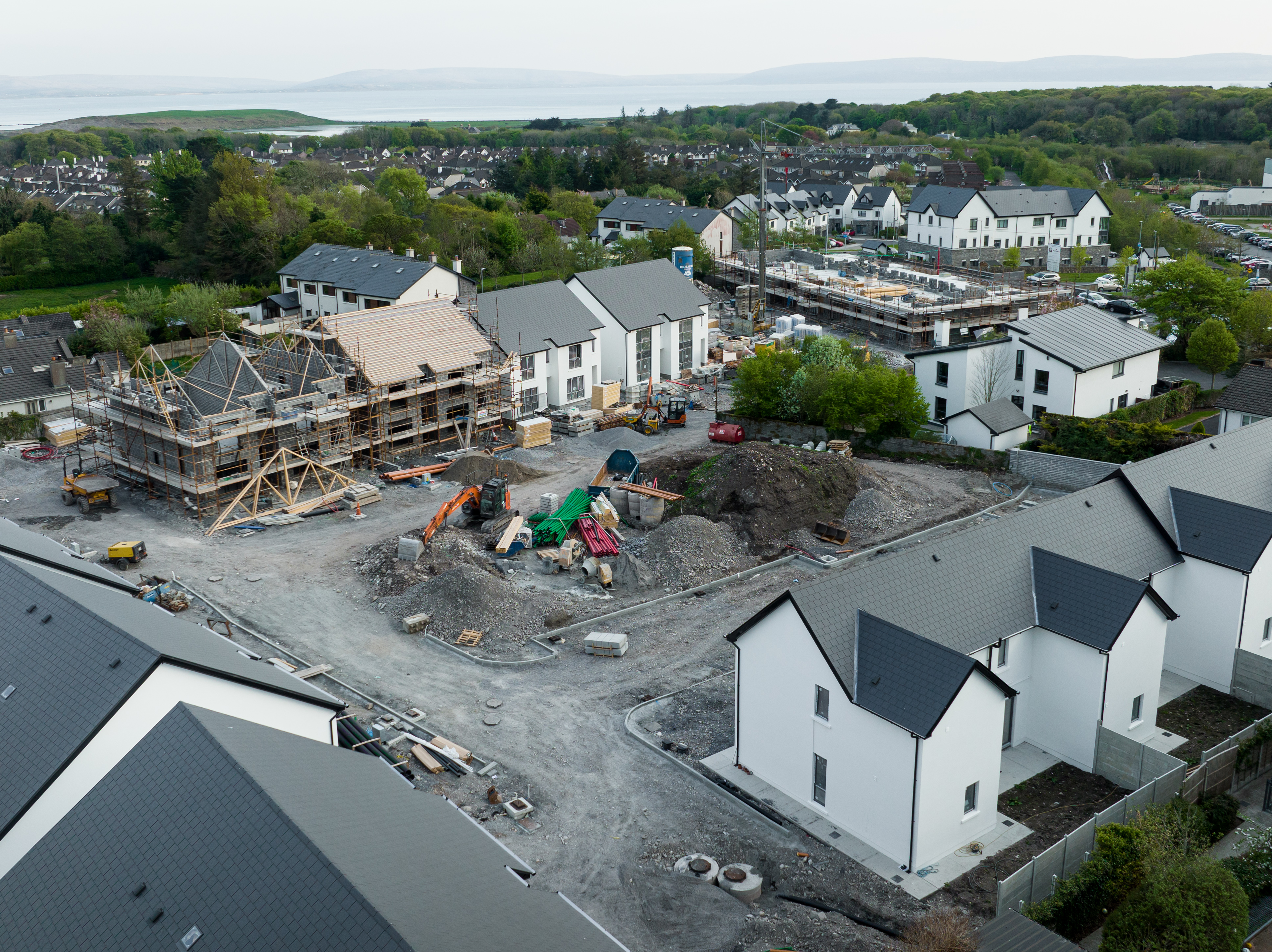
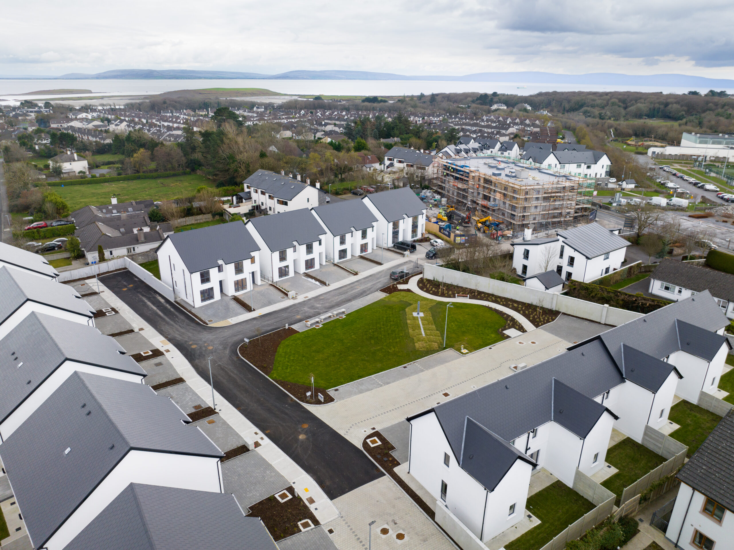
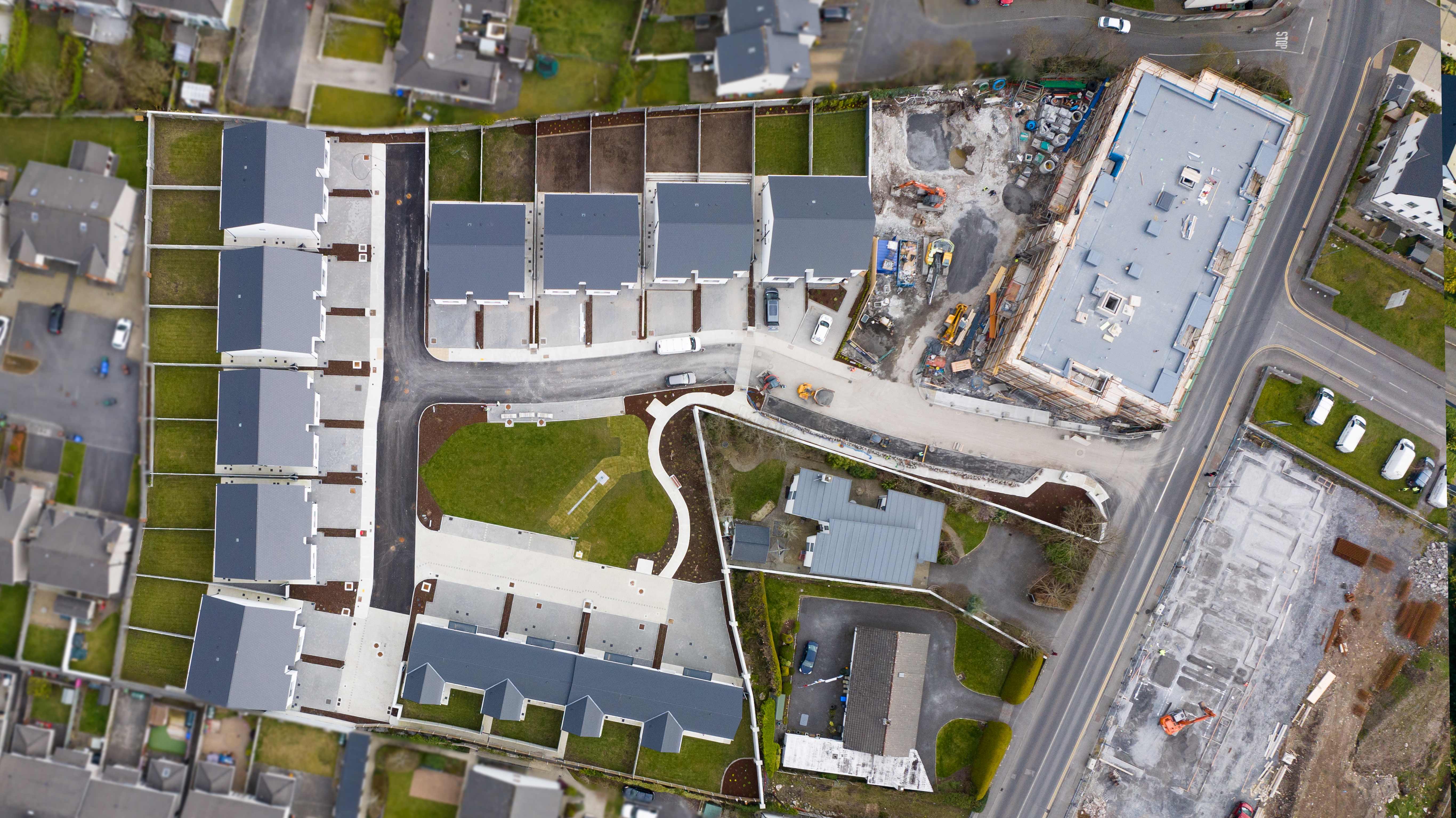
Superfly Ireland is a reputable aerial photography Galway company and a leading drone operator in Galway. We have had the privilege of working with many renowned clients in various sectors, including Alber Homes, a reputable property developer in Ireland. In this blog post, we share an aerial progress report for Alber Homes housing development, showcasing the benefits of construction progress photography and working with an Irish drone photographer for developers.

Our experienced team, including our Irish drone photographer, was tasked with capturing the development’s progress through aerial photos and videos. Despite challenges along the way, such as weather conditions and logistical issues, we were able to overcome them and deliver high-quality footage to our client. We made regular visits to the site to capture the development’s progress from different angles and altitudes, using state-of-the-art equipment, including drones and cameras with high-resolution capabilities. Our aerial progress report showcases our skills in construction progress photography, highlighting how we can capture a project from start to completion.

Nov_Cappagh_0593__ Nov_Cappagh_0593_4

Throughout the project, we worked closely with Alber Homes to ensure that we captured all the critical milestones in the construction process, including laying the foundation, framing, roofing, and exterior finishing. Our attention to detail sets us apart as a reputable drone operator in Galway and an Irish drone photographer.

Cappagh_March_2023-1-2_ Cappagh_March_2023-1-2

Construction progress photography provides an accurate and up-to-date record of the project’s progress, which can keep all stakeholders informed, including investors, shareholders, and future buyers. It also helps developers identify potential issues early on, enabling them to take corrective action before it’s too late. Our architectural photography Galway skills can help capture the beauty of the finished project and showcase the development to potential buyers.

Furthermore, progress photography can be used to market the development to potential buyers. High-quality photos and videos that showcase the development’s progress and features can help attract potential buyers and generate interest in the project.

Finish

Superfly Ireland is committed to providing our clients with the best possible service, and we are always looking for ways to help them achieve their goals. With our state-of-the-art equipment and experienced team, we offer high-quality aerial videography and photography services, including architectural photography Galway, to our clients.

In conclusion, our aerial progress report for Alber Homes’ housing development demonstrates the usefulness of construction progress photography and the benefits of working with an Irish drone photographer for developers. We look forward to working with Alber Homes and other clients on future projects.

Client: Alber Homes

REGISTER YOUR INTEREST

Denmark, Copenhagen: Addressing the challenges of climate change and urbanization through land reclamation.

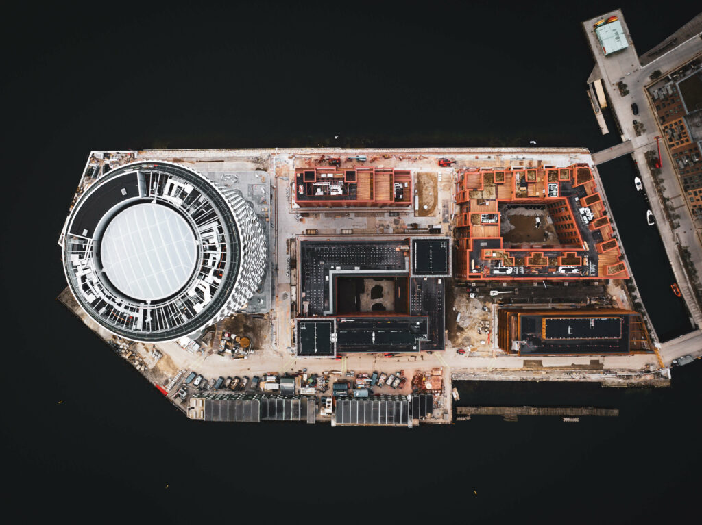
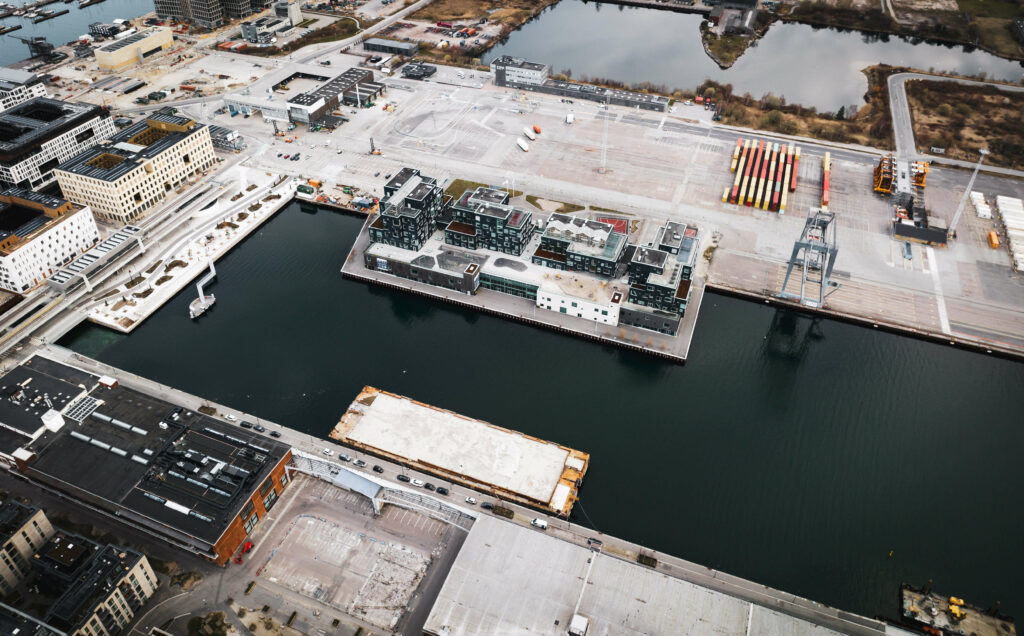
Nordhavn district Copenhagen Aerial Photography

Denmark, Copenhagen

Addressing the challenges of climate change and urbanization through land reclamation.

Denmark, Copenhagen: Addressing the challenges of climate change and urbanization through land reclamation.

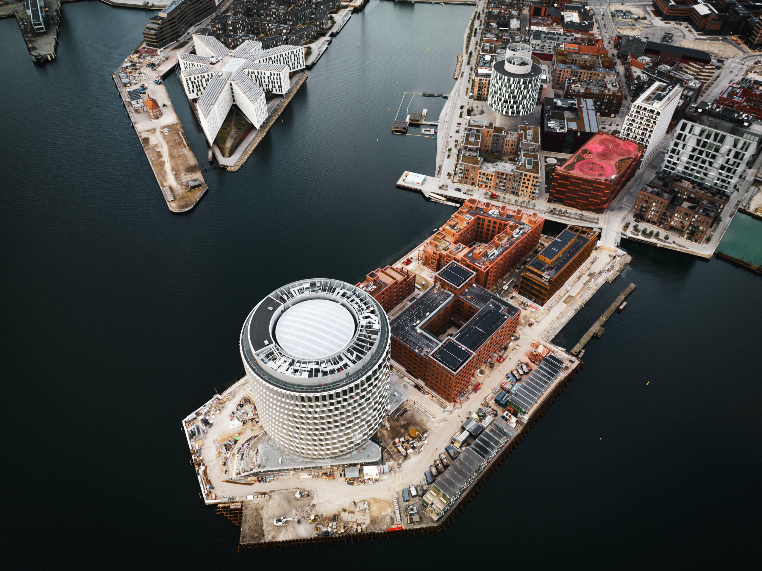
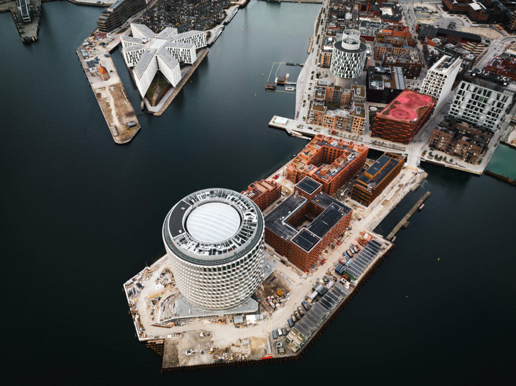
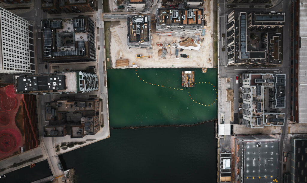
Early morning aerial photographs taken by drone photographer Superfly Ireland have revealed Denmark’s impressive land reclamation project around the Copenhagen harbor. The project, which aims to create more space for schools, apartments, and recreational areas, is a shining example of urban planning that prioritizes the needs of the community.

The process of reclaiming land is not new, and has been utilized in various countries across the world for centuries. It involves creating new land from bodies of water, such as seas, rivers, and lakes, through the use of various techniques, including dredging and poldering. Land reclamation projects are often undertaken to expand cities, build ports, or create new agricultural land.

Nordhavn district Copenhagen Aerial Photography
Copyright 2023 Superfly Ireland Request to Licence

The positives of land reclamation projects are numerous. Firstly, they provide a solution to the problem of limited space in densely populated areas. Reclaimed land can be used to build schools, hospitals, housing, and recreational areas, all of which contribute to a better quality of life for citizens. Additionally, reclamation projects can help protect low-lying coastal areas from the effects of rising sea levels and storm surges.

However, there are also negatives associated with land reclamation. One of the main concerns is the environmental impact of the process. Dredging and poldering can result in the destruction of marine habitats, loss of biodiversity, and pollution of the surrounding waters. Additionally, land reclamation projects can be expensive and can take several years to complete.

Nordhavn district Copenhagen Aerial Photography
Copyright 2023 Superfly Ireland Request to Licence

Despite these challenges, Denmark has been able to successfully reclaim land around the Copenhagen harbor for public use. The Danish government has invested heavily in the project, utilizing a combination of public and private funds to finance it. The cost of land reclamation varies depending on the size of the project, the techniques used, and the location. In Denmark, the cost has been estimated at around €1.5 billion for the entire project.

The project aims to create a new district called “Nordhavn” which will be an extension of the existing Østerbro district. The new district will cover an area of approximately 370 hectares, and will be able to accommodate 40,000 residents and provide 40,000 jobs.

  • The Nordhavn district will include a mix of residential, commercial, and public spaces. It will have about 8,000 residential units, with a mix of private and social housing. In addition, the district will have several new schools, parks, cultural centers, and other community facilities.

  • The district will also be designed to be environmentally sustainable, with a focus on reducing carbon emissions and improving energy efficiency. It will feature a district heating system, which will provide heat to buildings through a network of pipes, and a district cooling system, which will use seawater to cool buildings in the summer months. The district will also have a rainwater management system that will help reduce the risk of flooding.
Nordhavn district Copenhagen Aerial Photography
Copyright 2023 Superfly Ireland Request to Licence
  • The construction of the Nordhavn district is expected to be completed in several phases, with the first phase already underway. The first phase of the project, which covers an area of approximately 115 hectares, is expected to be completed in 2027. The entire project is estimated to cost around $1.5 billion, with funding coming from a combination of public and private sources.

  • Overall, the creation of the Nordhavn district through the land reclamation project around the Copenhagen harbor represents an ambitious and forward-thinking urban planning initiative. By creating a new sustainable district that is designed to meet the needs of its residents, Copenhagen is setting an example for other cities around the world to follow

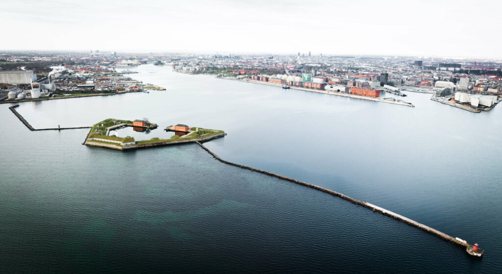
In addition to the new district being created through the land reclamation project around the Copenhagen harbor, there is also a new sea wall being constructed as part of the project.

The sea wall is being built to protect the new district from rising sea levels and storm surges, which are expected to become more frequent and severe due to climate change. The sea wall is being designed to withstand high waves and winds, and to minimize the risk of flooding.

The construction of the sea wall involves a combination of techniques, including the use of concrete blocks and geotextile fabric. The concrete blocks are being placed at the bottom of the harbor, while the geotextile fabric is being placed on top of the blocks to create a barrier that can absorb wave energy and reduce the risk of erosion.

Sea Wall Nordhavn district Copenhagen Aerial Photography
Copyright 2023 Superfly Ireland Request to Licence

The sea wall is not the only measure being taken to protect the new district from flooding. The land reclamation itself is also designed to help reduce the risk of flooding. By creating new land from the harbor, the project is reducing the amount of open water that is exposed to storms and waves. Additionally, the new land is being raised to a height that is above the projected sea level rise, further reducing the risk of flooding.

Overall, the new sea wall and land reclamation at the Copenhagen harbor represent a comprehensive approach to addressing the challenges of climate change and urbanization. By creating a new district that is both sustainable and resilient, Copenhagen is setting an example for other cities around the world to follow.

Nordhavn district Copenhagen Aerial Photography
Copyright 2023 Superfly Ireland Request to Licence

Denmark has a long history of land reclamation, with some of the earliest recorded reclamation projects dating back to the Middle Ages. The country’s success in this area is due in part to its geography – Denmark is a small, low-lying country with a long coastline, which has necessitated the need for land reclamation for centuries.

In addition to its geography, Denmark has also developed a strong expertise in the field of land reclamation through a combination of research, innovation, and collaboration between government, industry, and academia. The Danish government has provided funding and support for research into new techniques and technologies for land reclamation, and has also established regulations and guidelines to ensure that the process is carried out in an environmentally sustainable and socially responsible way.


One of the most significant contributors to the development of modern land reclamation techniques was a Dutch engineer named Cornelius Vermuyden, who was invited to England in the 17th century to help drain the fens in East Anglia. Vermuyden’s methods involved the construction of drainage channels and embankments, which allowed the land to be drained and reclaimed for agricultural use. His work paved the way for modern land reclamation techniques, which have been adapted and refined over the centuries.


Overall, Denmark’s success in land reclamation is the result of a combination of factors, including its geography, government support, and a long history of expertise and innovation in the field.

References

“Copenhagen’s harbour is being redeveloped to make way for 2km of housing, offices, shops and public spaces” – Dezeen 

“Denmark: Copenhagen’s harbor reclamation project begins” – Construction Review Online 

“Copenhagen’s harbor is being transformed into a new city district with 40,000 residents” – Nordic Business Insider